
The Willapa Hills Trail is one of Washington state’s newest and wildest recreational resources, and it begins seven miles from my front door.
Once a branch line of the Northern Pacific Railway connecting Chehalis and South Bend, the rail line was abandoned in 1990 and acquired by Washington State Parks for purposes of trail development in 1993. TrailLink has a nice history of the route here, and much of that history is still on display and in use as the trail goes over many of the same bridges once utilized by steam trains in the early 1900s.
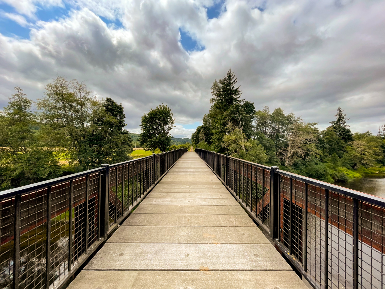
‘Tis a privilege to traverse the trail, and I do so often. Each time I do, it seems there is something new to discover along its right of way: a different perspective of the Chehalis River, the sun angle showcasing the vibrance of the foliage, or wildlife scurrying about and crossing the trail in front of me.
On Sunday, August 8, I decided to take my new Trek Marlin 7 mountain bike for a spin on the trail to get acquainted with the bike’s geometry and see how well it handled the gravel compared to my converted Fuji road bike. I’m a road cyclist through and through, but I’ve been feeling a need to diversify lately, so I sold some stuff and in turn bought the Trek.

I took off from the Adna trailhead and pointed west, having told a couple friends I wanted to log about 40 to 50 miles. From Adna, this route is rather simplistic — just keep heading west on the trail for 18 more miles until you reach Pe Ell, then continue up the Coast range foothills to your heart’s delight before heading home.
Only this ride would bring me even further. Cool weather and good nutrition helped in my effort to tromp up the Pluvius pass, back down the other side, and reverse my route to get home again.

I didn’t take into account the fact that yes, I could fit two water bottle holders on my bike, but the geometry of the bike prevented me from bringing one as it was too big. Rats, I’ll have to do better next time. But that does bring me to a good point for anyone traversing the trail: there are a few good opportunities to get water at Rainbow Falls State Park (mile 15.5), Jones Creek Brewing (mile 20.5), and a small smattering of cafes in Pe Ell (mile 22).
From there on out it gets pretty remote, but we’ll get to that later.

On this day the wind was out of my west at about 4-5 mph, ensuring I wouldn’t have a fast trip to Pe Ell and beyond. Most of the time during the summer, that’s par for the course — a northwesterly wind keeping my ride honest and governing my speed. Can’t complain about that with a bunch of scenery around.
My mountain bike is about 30 pounds, and the bag I attached to the seatpost added 5 pounds to it. Usually in my bag I’ll bring an extra tube, tire levers, CO2, an allen key set for quick fixes, a tad bit of food and a camera. The bag usually weighs down my converted road bike, but the Marlin handled it like a champ and kept sailing westward.
The trail passes through areas that seem nondescript now or only have a few homes remaining, yet were once thriving and vibrant mill towns. In fact, lumber was one of the main reasons this railroad existed, with trains bringing wood by the carload from these small timber towns like Doty, Dryad, McCormick and Walville to South Bend for export.
Very little signs exist that these mill towns even existed, with time and nature taking over the land. Yet the trail remains.
Photographer Clark Kinsey photographed some of the mills along the route in the early 1900s, and the University of Washington Library has several of his photos in their online collections. Here’s one of a steam engine at the Leudinghaus mill at Dryad.

West Lewis County isn’t exactly known as a recreational haven. The stretch of SR 6 between I-5 and the Pacific County line only takes you to one place well-advertised that you can spend the night, and even then you have to bring your own tent, bivy or RV. That’s Rainbow Falls State Park, and it sits right off the trail at mile 15, halfway between the Chehalis Trailhead and the Pluvius hills.
Most of the tourism marketing focuses heavily on the Twin Cities of Centralia and Chehalis as they’re halfway between Portland and Seattle, and especially on the Mount Rainier area of east Lewis County. Mountain tourism is big business around these parts, and it seems that the western part of the county hasn’t gotten a lot of respect in regards to tourism.
That’s changing, though, and it’s about time.

Washington State Parks has made some significant investments in the trail over the past decade especially, paving the first five miles between Chehalis and Adna, and laying down compact gravel for the remaining mileage in Lewis County. The trail is functionally complete over its 26 mile length in Lewis County — but there are 30 more miles of it that exist in Pacific County and connect to towns at the mouth of the Willapa River.
It won’t be long before all 56 miles of the trail are connected and fully rideable by folks from all walks of life, all ages and all abilities. But there’s still some work to be done, and piece by piece it’s coming along.


Over the past few months, I’ve met more people using the trail that have traveled from areas that require a full day trip or weekend to get here. People are taking notice of the trail, its rugged nature, peaceful surroundings, and maybe most importantly it’s separation from traffic.
On this day, I met cyclists from Gig Harbor, Seattle and Vashon — areas that are at least a two-hour drive from Rainbow Falls State Park, where they said they were staying.

Riding west of Pe Ell is where the real adventure begins. The trail begins to ascend out of Pe Ell and waves goodbye to the Chehalis River, with Rock Creek taking its place and meandering along the trail, under it and away from it in a winding and twisting path that you seem to follow along for at least five miles.
Over the first 22 miles of the trail between Chehalis and Pe Ell, you only gain about 200 feet in elevation. Over the next eight, you’ll gain about 500 as you ascend gently toward Pluvius.
And the ride is absolutely beautiful.

The history in this area is quite rich, with forested areas overtaking what once were the mill towns of McCormick and Walville. Pluvius, at the top of the grade, has an interesting history.
Author Stewart Holbrook, in his book Far Corner, describes a visit to Pluvius and the area’s “sole resident” telling him that it rained 362 days out of the year there, with the other three being “g**d*** cloudy.”
Guess what, it sprinkled on me at Pluvius on my ride. The dude was right.

To ride the trail is to come front and center with the history that brought this trail to life as a railroad more than a century ago, and each time I ride it I am invigorated and filled with a respect for the people who came here before I did. They lived a hard life, and the logging industry out in these parts could not have been easy.
There is an interesting feeling that comes when you realize the juxtaposition of this corridor having been so many people’s lifeline to the outside world before the automobile era, and here I am having driven my car to it so I could ride my bike across it for leisure.

In these deep woods of the Pluvius hills one finds a sense of self-worth and peace, takes some time to pray for a few, and points the bike back east to head home after a full day of cycling. An unplanked and rotting trestle curves into the distance and I have no intention of traipsing across it.
Off I climb again back east, and while I am not the biggest fan of out-n-back rides, I do enjoy getting to see areas of the trail I just rode through from a different perspective.
Climbing out of Pluvius is an exercise in and of itself.


By this point in my ride I’ve reached the 30-35 mile mark and I’m feeling okay. The mountain bike and its flat bar setup are a welcome change from the drop bars I use all the time on my road bike, and I enjoy the increased stability the bike offers. More than 30 miles on the MTB’s maiden voyage is a GOOD DAY, and I would nearly double that when all was said and done.
I didn’t take many photos on the way back, but of those I did take, a few areas always cause me to stop and pause to enjoy the serenity of those specific spots.


When my day in the saddle ended, my Garmin Edge reported that I had traveled 58 miles. I was thoroughly spent, having done nearly a metric century on a mountain bike on gravel. Infinitely tougher than a metric century on a road bike. Couple that with 900+ feet of gain and it was a day well spent in the saddle.
I’d definitely recommend a visit to the WHT for every cyclist in Washington state. It’s a great way to enjoy a peaceful ride, and also to come front and center with the history that shaped our region.
Here’s my Strava track from the ride:
Oh yeah, and I’d be remiss if I didn’t provide directions to the trail. My favorite place to start is from the Adna trailhead, five miles west of Chehalis. From I-5, take Exit 77, head west toward Pe Ell, and follow the signs to the Willapa Hills Trailhead (take a right at Bunker Creek then another right at Dieckman, then a left into the trailhead). Discover Pass is required.
Here’s a Google Map to the Adna Trailhead (this might work better than me describing it).
5 Comments
Makes me want to get on my bike more! Thanks for sharing with us!
Thanks for reading brother! You and your family would make for an AWESOME paceline out on the trail!!!
What a recap! I think you singlehandedly convinced everyone to get a bike and ride this trail. Great photos too. The historical aspect makes this trail even more special.
I’m gonna keep putting the bug in your ear to get down here and check it out! I love this trail so much. There is an old Japanese cemetery I was going to visit that isn’t far from the trail, that tells a very interesting historical story about one of the old mill towns. Maybe fodder for another blog post soon-ish…
Fabulous ride report on a gem of an trail. I love the comment about the trail being a mere 7 miles from your door. I agree with you, a walk in/bike in camping site would be a great addition and I sure hope it’s a consideration once the west side improvements are in place. And congrats on the new whip!