
There is no better season than autumn, and there is no better way to enjoy the vibrance and splendor of the falling leaves than to do so on a bicycle.
A friend had texted me earlier in the week and asked if I wanted to join them for a ride on the Crown Zellerbach Trail, a former logging railroad grade mixed in with some logging roads that connect the towns of Scappoose and Vernonia, Oregon. I had only done the entire thing once, back in September 2023, and jumped at the opportunity to do so again.
The Crown Zellerbach Trail, or Crown Z as it’s more often referred to, differs from other rail-trails in our region in that you’re either ascending or descending most of the time on it. Most rail trails tend to have either a gentle grade or maintain some sort of flat grade for stretches; by comparison, the Crown Z was once a logging railroad through and through, and as such you end up gaining some pretty good elevation no matter how much of the trail you do.
I drove down from my place in Centralia and encountered heavy fog for most of the journey. I-5 south to Longview was socked in it, and Highway 30 on the Oregon side less so, but still significant; the fog didn’t ease until about an hour into our ride. I chose a hybrid of cold weather pants, thick socks, and my summer jersey under a windbreaker — but fortunately, as the day wore on, the clouds parted and the sun made an appearance, and temps topped out in the mid-50s. Pleasant riding temperatures for sure.
My bicycle choice of the day was my still relatively new Priority Gemini Smart.Shift Gravel, a belt-drive bike trades a traditional derailleur and chain setup for a gearbox attached to the frame that handles shifting electronically. More on that later…
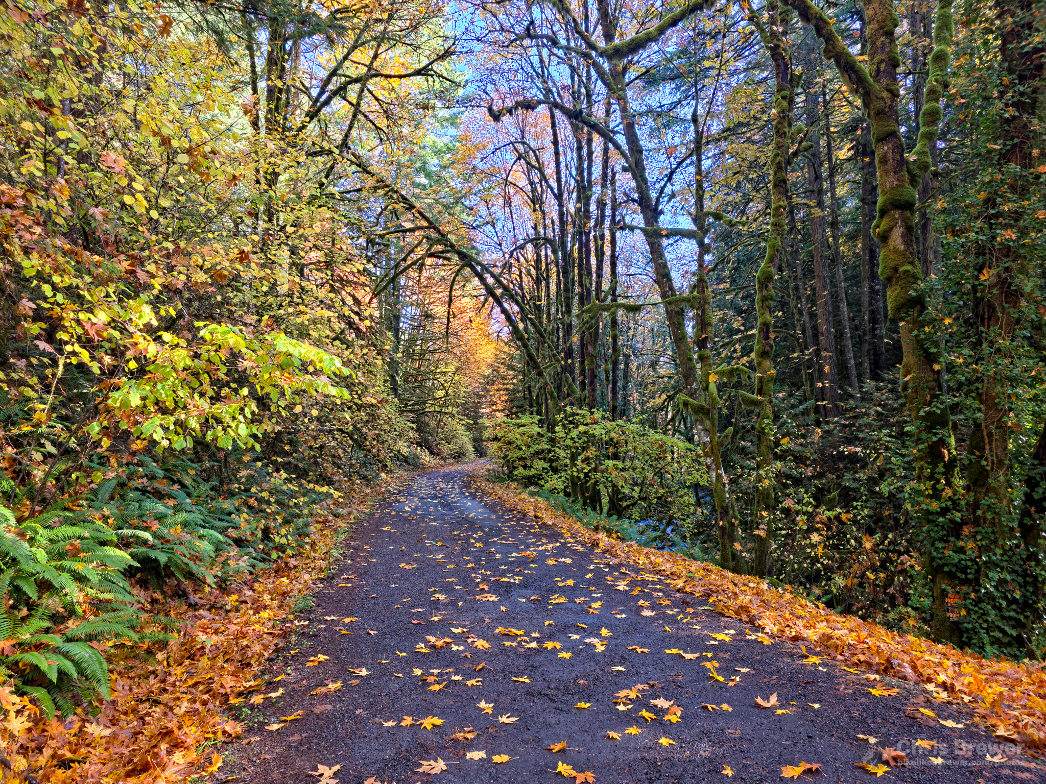
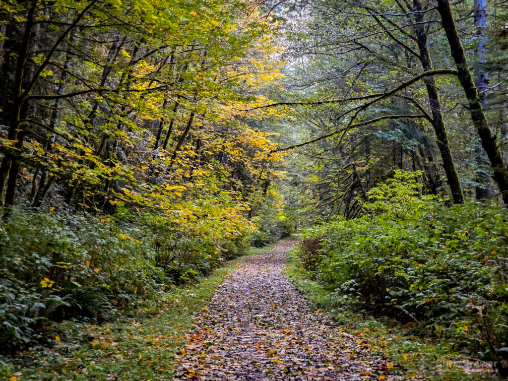
After meandering through Scappoose a little bit, we made our way onto the Crown Z from U.S. Highway 30, riding up toward the Pisgah Trailhead on a trail that had a hybrid surface of gravel and some concrete roadbed portions that still remained. Leaves had fallen over portions of the trail and we had to be careful to ensure we didn’t hit any potholes or debris. Fortunately the conditions would improve, and once we passed the Pisgah Trailhead a couple miles out of town, the trail begain to ascend through a beautiful forested area that provided a preview of the colors that awaited us.
Growing up in Rainier, Oregon, just a half-hour west of where we were biking on this day, I had known there was an extensive timber history in Columbia County. What I didn’t know until my late childhood and early teen years is just how much railroad infrastructure had once been built to support it; and it took until well into my adult years to be able to use those corridors for recreational purposes.
The Crown Z Trail brought trains that carried lumber over the hills of the Coast Range, and our bikes traveled that same path up, up and up to the Nehalem Divide about 1,300 feet above sea level, passing some seriously beautiful scenery along the way. We had to take our time to stop and admire the view a couple times.
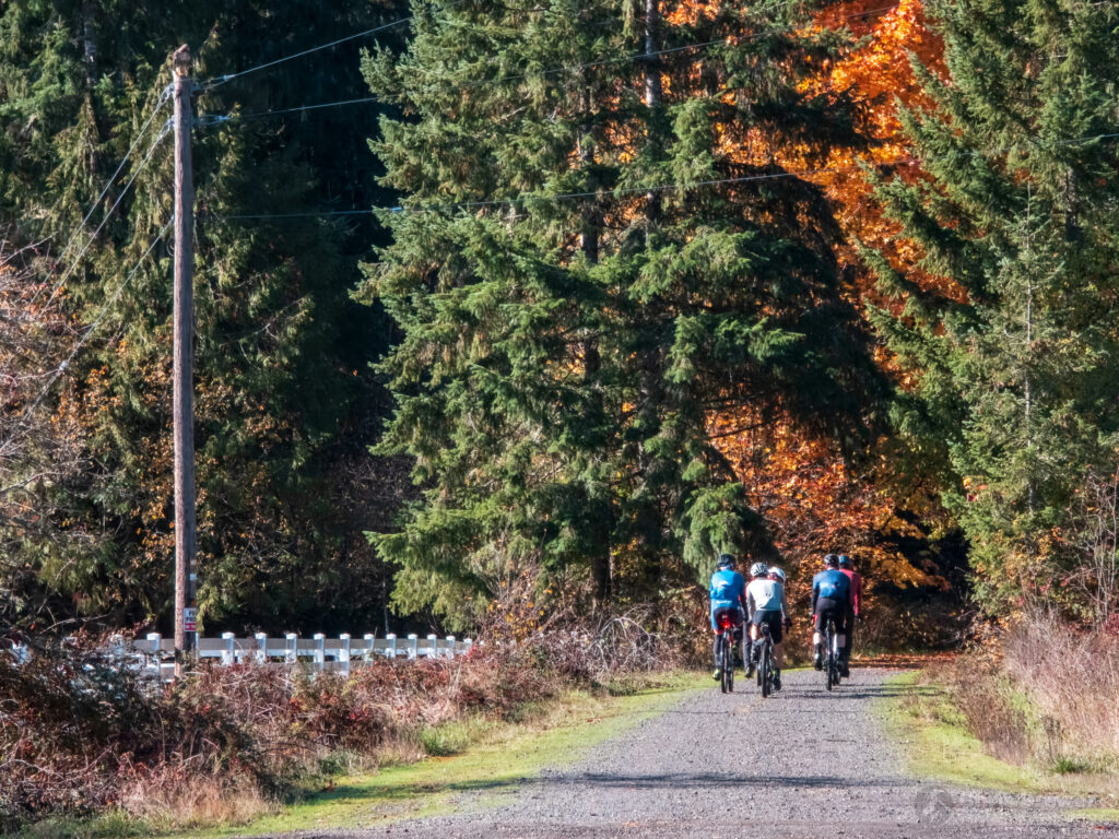
We met a few cyclists from the Portland and Vancouver area, and in fact they were the same group that I had waved at as we passed by them at Cathedral Coffee in Scappoose. They were hauling up the hill and making very good time, and we all stopped for a break at the Ruley trailhead before the journey began to get even a bit more difficult.
My Garmin said we were about to go up a two-mile long ascent with about 600 feet of climbing. I was ready for it, and although I had suffered a migraine the day prior and wasn’t feeling 100 percent, my legs said “Let’s do this!”
I can’t really climb on the bike and shoot photos that well, and especially not when the climbs reach 8 percent, then 10 percent, then 12. Pretty tough sledding for a rail trail, but something I’m definitely used to, and became stronger at as the day went along.
It’s hard to imagine trains chugging up these portions of hill, but then you do some digging and realize the trail at this point just before the Nehalem Divide has abandoned its original route, which actually took it through a tunnel that is tucked away, for 25 years or so ending in 1940.
Seriously, check this video out. The tunnel exists right under our noses on the trail, but it’s in major disrepair.
I love exploring historic artifacts, but I definitely didn’t even think about the tunnel yesterday. It only occurred to me after the fact that the tunnel was nearby, but we had descended too far for me to even think about even trying to get near one of its portals.
Besides, I didn’t feel like doing any hike-a-bike adventuring any more than I already needed to.
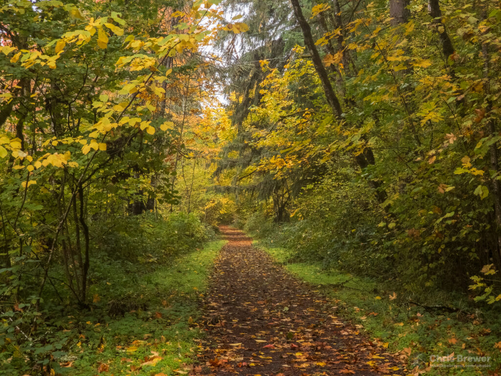
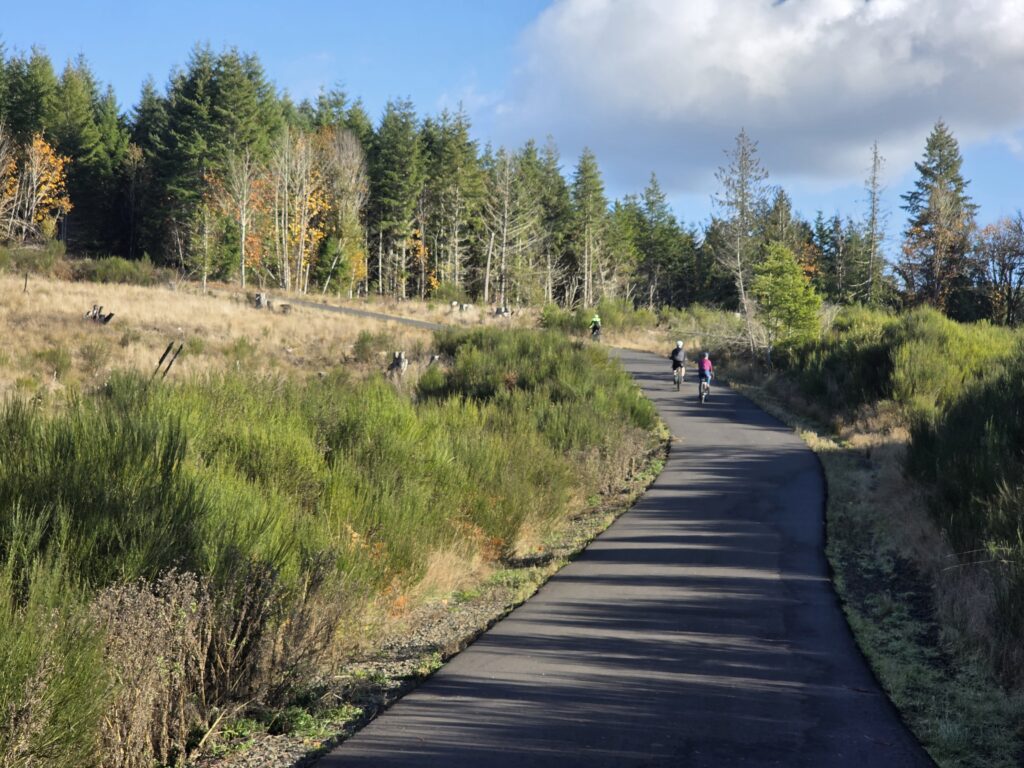
Once at the Nehalem Divide, we had reached our highest point on the trail, and that meant it was time for a fun and very beautiful descent through a forest that had all sorts of different trees showing their colors. This would be one of the most beautiful stretches of trail I’d experienced in recent memory.
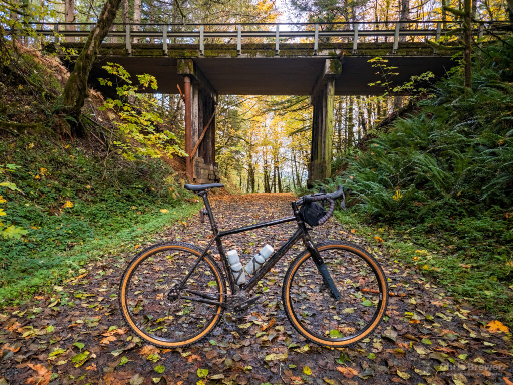
I had brought my GoPro Hero8 and had it all charged and ready to go. In fact, if you look closely enough at the photo above, you can see where it juts out just above my handlebar bag, giving enough clearance for both my Garmin Edge bike computer to mount properly and for me to unzip the bag should I need anything while riding like food or anything else I’ve brought.
The descent ended up being about four miles and it took about eight minutes or so. I didn’t want to take it fast at all as it had rained to beat the band the day prior and several areas of the trail were slick with mud under the fallen leaves.
But man, what a gorgeous stretch of trail the Nehalem Divide to Floeter Trailhead section is. If you get the chance to visit the CZ in fall, this is the section to do.
Here’s the unedited GoPro footage I shot, and I have to apologize for the audio going muffled and the mud on the lens part way through. I recommend watching it in at least 1080p60 if your device supports it.
Seriously, what a fun descent and a wonderful visual treat. I don’t think I’ve been on as beautiful a section of trail as this in a long time. It really brought to mind how much I treasured growing up in Columbia County, and I really wish that this trail was around when I was younger.
As we continued on past the descent, we ended up hitting an open area that once was home to a logging camp before crossing over the Scappoose-Vernonia Highway at grade and hitting the Pebble Creek logging road, which ascends 520 feet over 1.1 miles and will test your heart rate. It certainly did ours.
When you reach this second climb, you’re so tantalizingly close to Vernonia that you can literally smell the taco truck at the center of town. But to get there, you’ve gotta earn it and burn some calories to ensure you’ve done so.
Consider it earned. I held a steady pace and reached the top after a bit of a slog and my heart rate reaching the 170’s. Then it was time to descend again, this time into the town of Vernonia — but not before this view opened up:
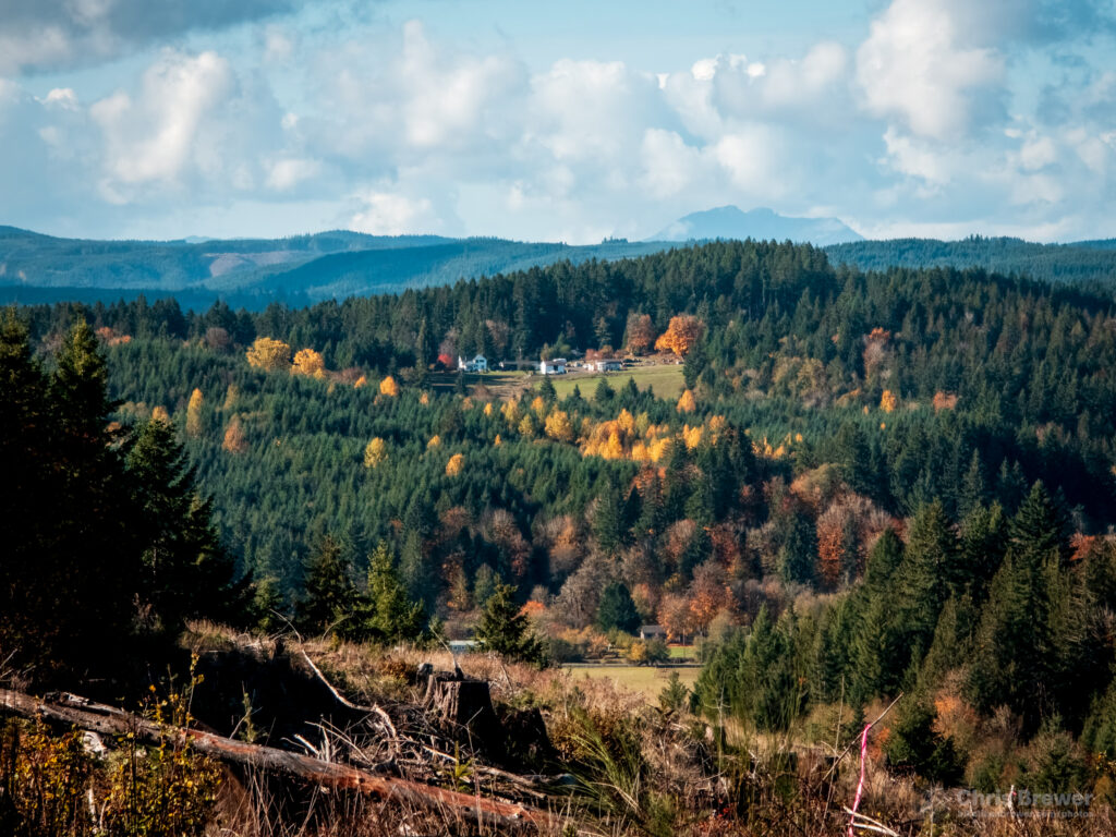
We stopped for a couple minutes to enjoy a beautiful view of the valley below and then headed back onto the trail for a very sharp descent to the Holce trailhead just a mile and a half outside Vernonia. The trail itself had ended, but we were on some safe-to-ride side streets, and even Oregon Highway 47 is safe enough to ride with generous shoulders and signage urging motorists to share the road.
In Vernonia proper, we stopped for lunch at the Black Iron Grill and nearby El Amigo taco truck. I didn’t get a photo of the outdoor seating area, but let me just say that Vernonia has done a fantastic job of embracing two trails that connect to each other in town, the CZ and the paved Banks-Vernonia State Trail. There were at least 10 other cyclists eating and chatting, enjoying the weather and sharing a bit about each other at this seating area, and for me that was one of the true highlights of the ride.
Verrnonia used to be a logging town but has changed over the years as just about every timber town has. Rail lines have become trails and Vernonia has really transformed, especially rebounding fantastically from the devastating 1996 and 2007 floods. I enjoy this place every time I visit, and I heartily recommend camping out by the river at Anderson Park if you get a chance…I did so for the 2024 Columbia Century Challenge and really enjoyed the peaceful setting by the Nehalem River.
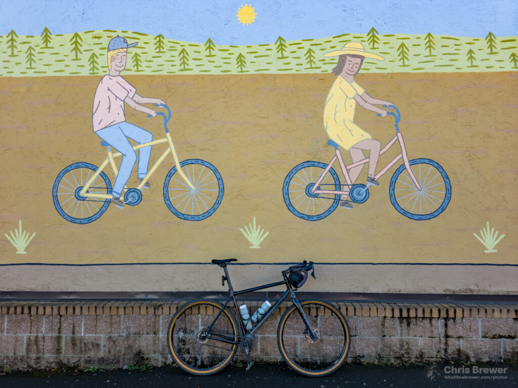
On this day though, our visit to Vernonia was only a day trip. I dropped on by the Vernonia Market to grab a Powerade and stopped to take a photo of the mural on the side of the building:
The day of our ride was coincidentally the first day after setting our clocks back an hour, which meant it would start to get dark around 5 p.m. Looking at our watches and seeing a 1 p.m. time kicked us into gear to get back on the trail, so we meandered around Vernonia Lake, back to Oregon 47 and over to the Holce Trailhead again.
Have I mentioned how beautiful the fall colors were in the Coast Range and Nehalem Valley? Good Lord they were great.
I mentioned the sharp descent down to Holce from the top of the logging road earlier, and uhhhh we had to go right back up it. I had read that there were a couple 20+ percent climbs on this stretch, and as it turned out, they weren’t lying.
Did I have to hike a bike up this steep portion? I dunno. Did I?
As it would turn out, Strava had part of this section pegged at 24 percent. TWENTY FOUR!
Insanity.
We climbed about 600 feet in less than a mile, which is one of the steepest segments I’ve ever climbed. The descent on the other end back to the trail was wonderful though, and once we crossed the Scappoose Vernonia Highway and got back onto the old railroad section of the trail, we found ourselves once again on a much friendlier section of trail.
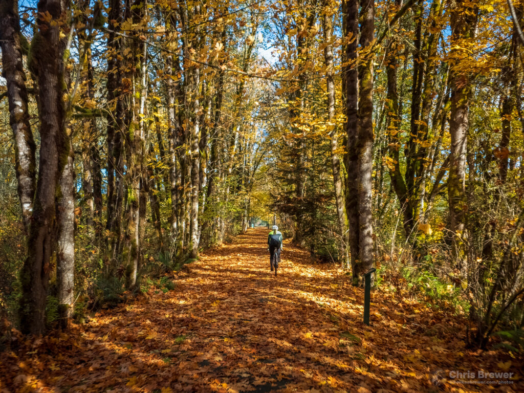
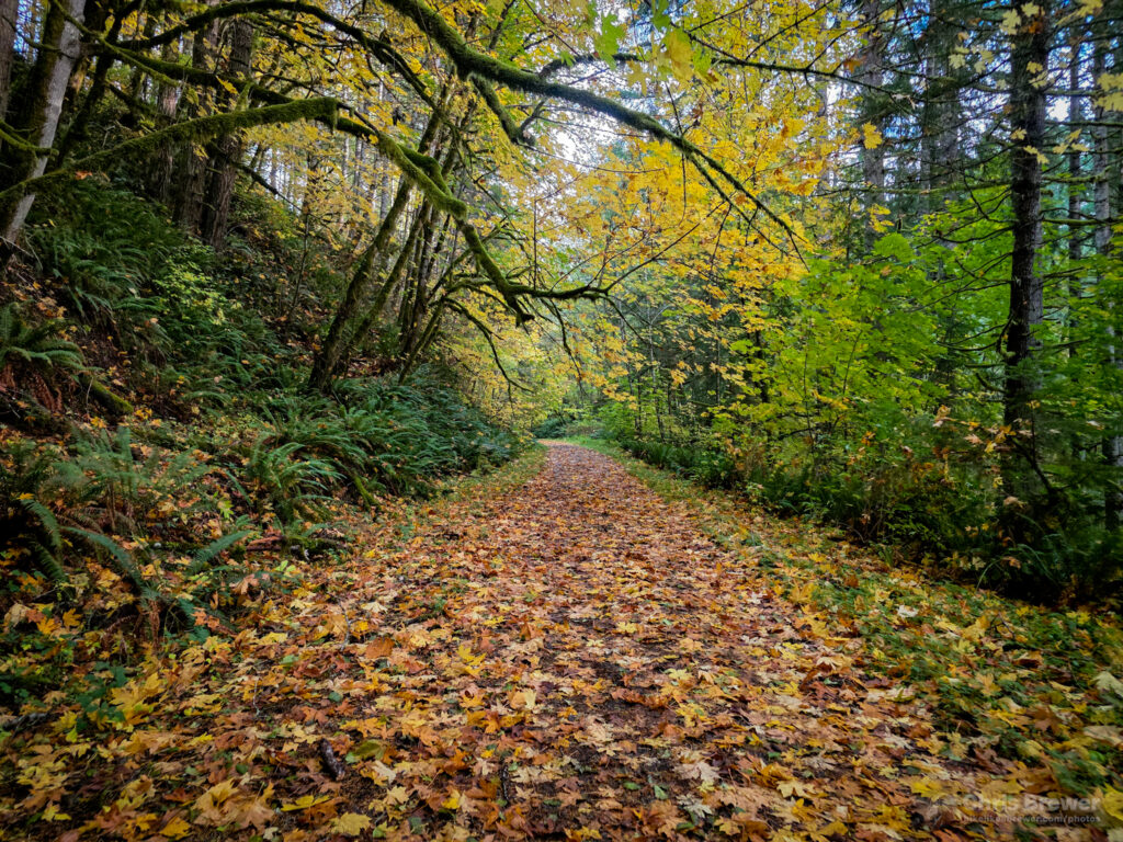
This section was awash in resplendent fall colors with some trees about to lose their leaves completely, and others having just turned, being a bit fashionably late to the party.
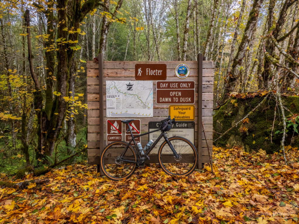
We stopped for a break at Floeter Trailhead, where I wanted to stretch for a second and get a photograph of my bike. One thing I wanted to document was the trailhead signs: the Columbia County Parks Department has done a fantastic job fashioning trailhead signage that outlines trail etiquette, what is and isn’t allowed, showing where you are relative to the rest of the trail, and more.
As the sun started to lower behind the trees, we recognized that we still had some decent daylight, but the harsh sun angles gave way to a softer lighting that enhanced the vibrance of the golden brown, yellow and red leaves all around us. Even though we had to climb another 600 feet or so over four miles to the Nehalem Divide, we took our time and really enjoyed the scenery around us.
We reached the Nehalem Divide at about 3:30 p.m., which was good news considering we had set a 5 p.m. deadline to get back to the cars in Scappoose. The divide was the summit of our trip, and we had to essentially descend nearly the entire way back to town. To make up even more time, we descended about four miles of it on the road.
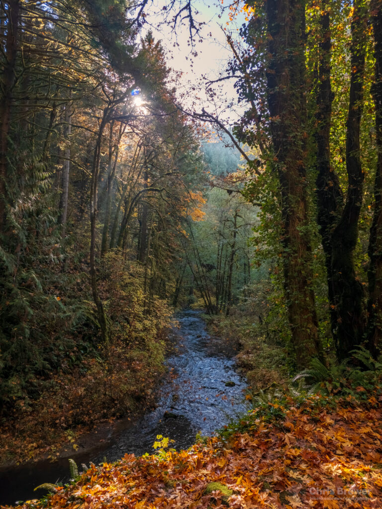
Jumping back onto the trail for good around the Ruley trailhead about eight or nine miles from the cars, we descended at about 15 mph through several areas of trail that, while right next to the road, had these pockets of peace and seclusion as a branch of Scappoose Creek flowed next to the trail. A really beautiful soundtrack to end the day on, I’d say.
I admit I’m a bit rusty on both my blogging skills and coming up with a lot of good descriptiveness for the ride, but I hope the photos I shared here provide some of the perspective that I can’t find just yet in words. This is my first blog post in easily three years on my website — my last one was recycled from a previous iteration of my website — and I’m happy to say the writer’s block that hit me pretty hard is gone, but I’m really rusty. Thanks for hanging with me this long and I hope you really enjoyed the trip.
Links, resources and other good tidbits:
- The official Crown Z Trail website has a wealth of information not just about the trail, but the history surrounding it. I took some time and read a lot of it, and in doing so felt a deeper connection to the history of the area. Big thanks to those who took the time to research, share the photos, and write the stories.
- If you’re on Facebook, there’s a public Friends of Crown Z Trail group in which updates and photos are posted by group members on occasion.
- Electric car owners like me will be happy to know that the Columbia River People’s Utility District maintains a set of ChargePoint chargers in Scappoose near Veterans Park, just off U.S. Highway 30 and not far from where the gravel portion of the trail begins. I was able to charge for just 13 cents per kilowatt-hour. Here’s a Google map to it; if you drive a Tesla there are also chargers next to the ChargePoints.
- As of the time of this post, there is active logging at trail mile 12 and the trail is closed for about a mile or so between there and the Nehalem Divide Trailhead. You have to go around on Scappoose-Vernonia Highway, and that’s not a great option for less than experienced cyclists going uphill because of a few blind corners and vehicles driving at a high rate of speed.
Leave a Reply