Sunday, May 29, 2024 was a day unlike any other on the Willapa Hills Trail. For the first time ever, a decent-sized group set out to take on the 56-mile trail’s entire length in both directions on the same day.
This ride would be my third such ride, covering the entirety of the former South Bend Branch of the Northern Pacific Railway in both directions, primarily to showcase the fact that despite the trail being incomplete, an epic and rather adventurous ride can be had — and maybe more important, to bring people out to see the more remote sections of the trail for themselves.
You can do it too, and in this post I’ll share our experience and give you some tips on how to conquer the Megawillapa ride yourself!
What is the Willapa Hills Trail?
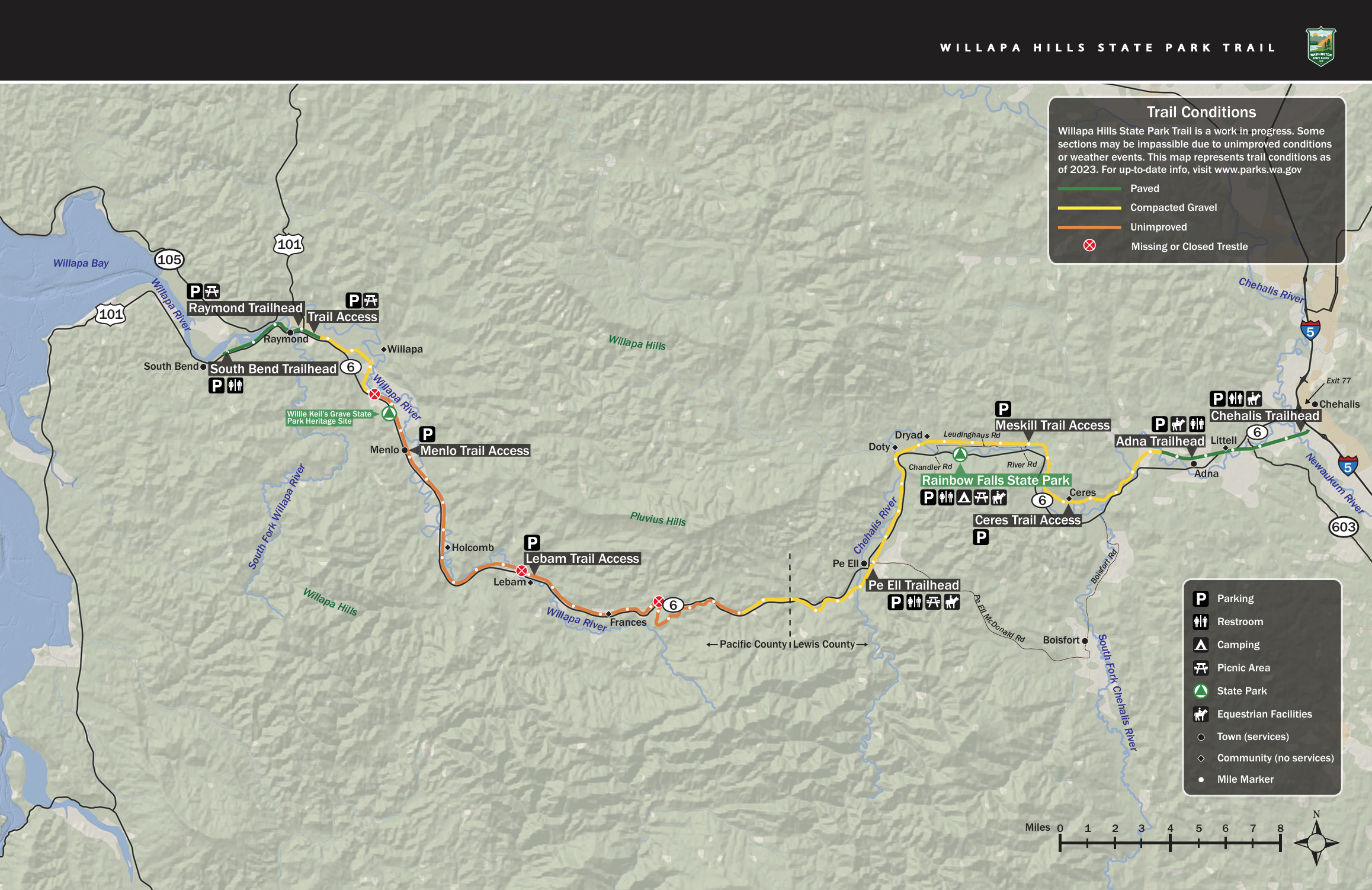
This trail map of the Willapa Hills Trail exists on Washington State Parks’ site and is borrowed from the source. Please click the map to see the entire PDF on their website. (Courtesy photo: Washington State Parks & Recreation Commission)
For the uninitiated, the Willapa Hills Trail is one of a few long-distance trails owned and managed by Washington State Parks. Formerly the South Bend Branch of the Northern Pacific Railway, the railroad was converted to a trail and has been under construction in various forms over its entire 56-mile length since the mid-to-late 1990s. The trail runs from Chehalis to South Bend, carrying people on two feet, two wheels, and other means of non-motorized use on a corridor that once carried people on trains.
Over the past decade, significant progress has been made on several sections of the trail. Go back just a few years past that and you can hit the milestone of the Chehalis to Adna section being paved in 2011. A total of 5.5 miles of paved trail are available in this area and are the most popular of the trail, attracting joggers, hikers, cyclists and even equestrians. I’ve even seen a fair amount of people with their cameras capturing photos of birds and other wildlife.
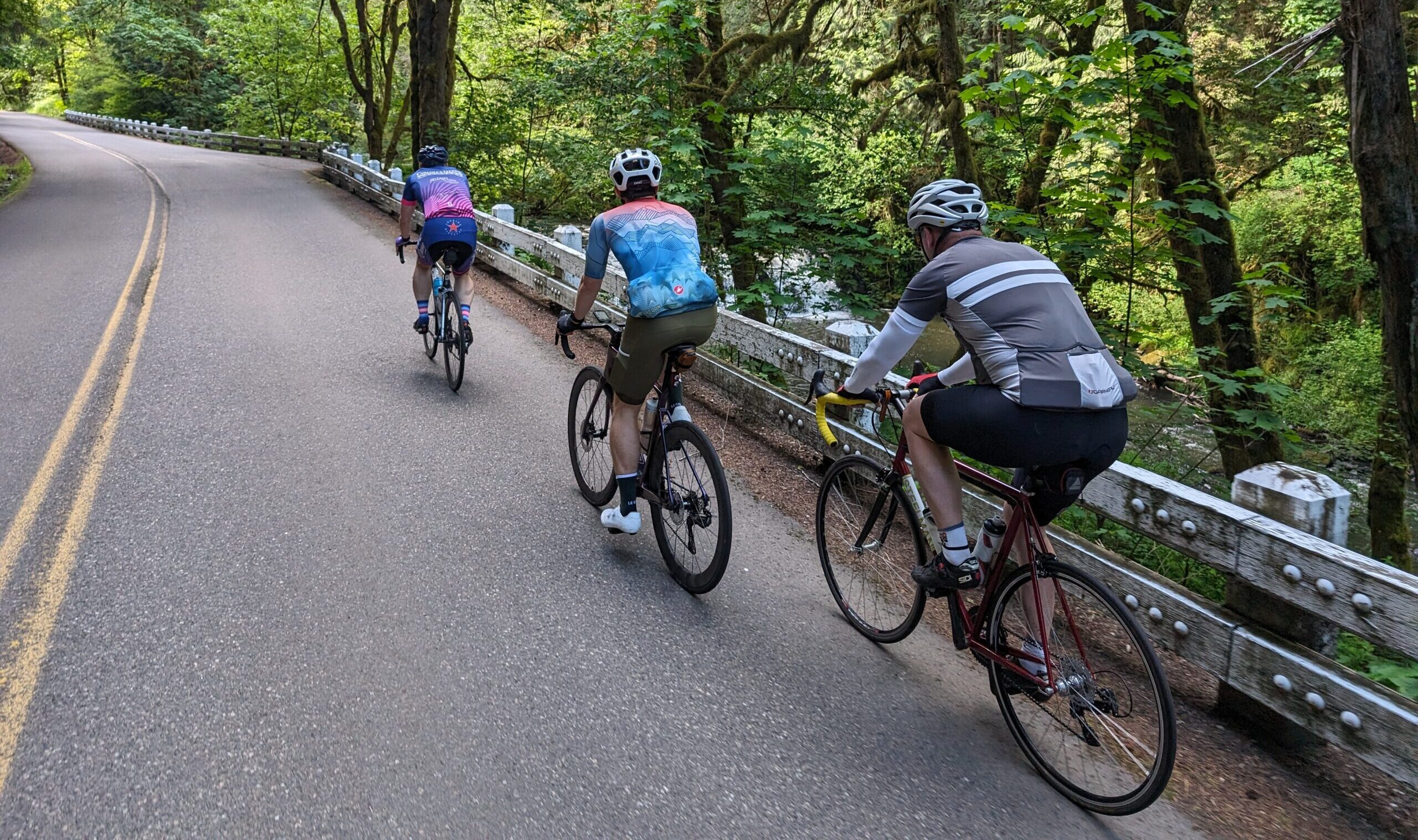
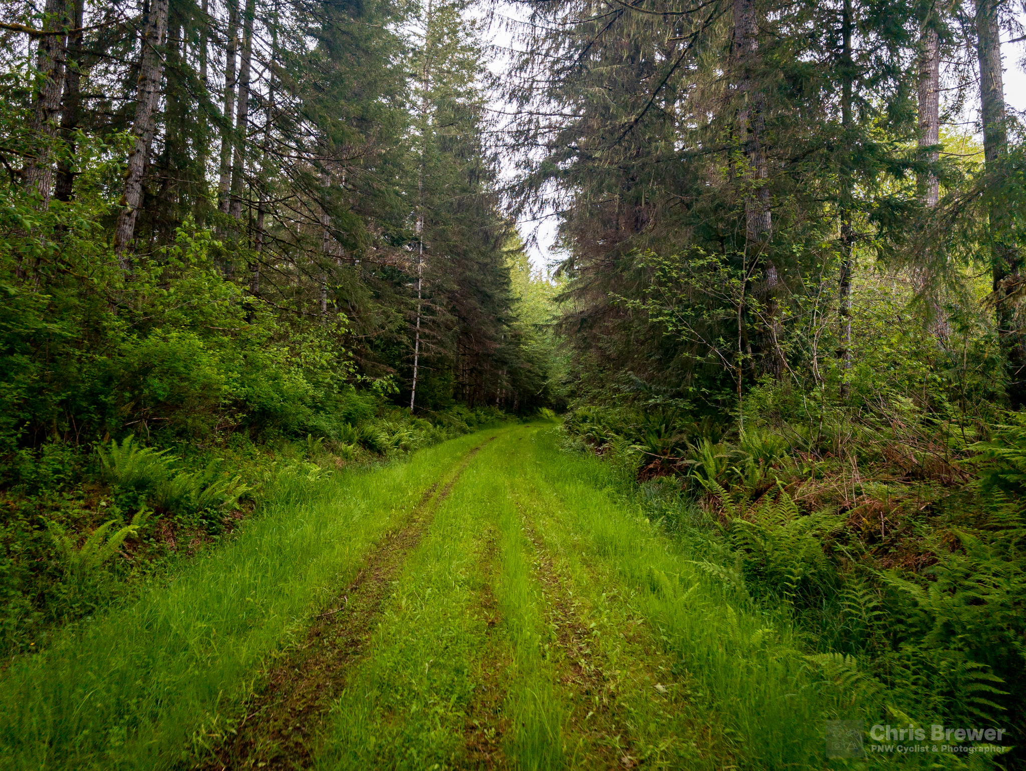
Most of the trail is gravel, and the depth and consistency of it varies. Therein lies the adventure: for a few good miles you’ll have a surface that rolls like hardpack, then suddenly the gravel is a bit bigger and you find you have to expend a few more watts. Once you get past Pe Ell the going gets tougher, but the scenery in the Coast Range portion is absolutely beautiful. I mean, I would ride through absolute h*ck just to get to this:
The Willapa Hills Trail rolls alongside the scenic Rock Creek just two miles west of Pe Ell.
The real adventure begins once you hit the crest at Pluvius, so named for the incessant rains that hit when folks were working in this area. Now a ghost town, it’s the highest point on the trail, and it offers an absolutely amazing descent of about 6 miles at a 2 percent grade in each direction.
Head west and you get into the really unimproved section of the trail, as the map above shows. Beloved Pacific County locales such as Frances, Lebam and Menlo greet you on your way over hard rock and even a grass surface here and there; the historians among you will know where Holcomb, Globe and Nallpee once were.
The trail goes all the way to South Bend for a total of 56.5 miles, and while it doesn’t climb a ton, the real challenge is in the distance, varying terrain, and sometimes unforgiving wind conditions.
I like that kind of a challenge, and knowing that work is still ongoing to improve the trail further west, I wanted to tackle that challenge head-on while a big section of the trail is still wild and untouched.
How This All Started
In May 2023, I had an ambitious idea: Could I ride a bike across the entirety of the Willapa Hills Trail, in both directions, in one day?
Stories of people who had ridden the trail in one direction, camped overnight in Raymond or areas nearby, then returned the next day are many among my cycling friends. But after checking with just about everyone I knew, not one of them nor anyone they knew had ever tried to do the whole thing front to back and front again in the same 24-hour time period.
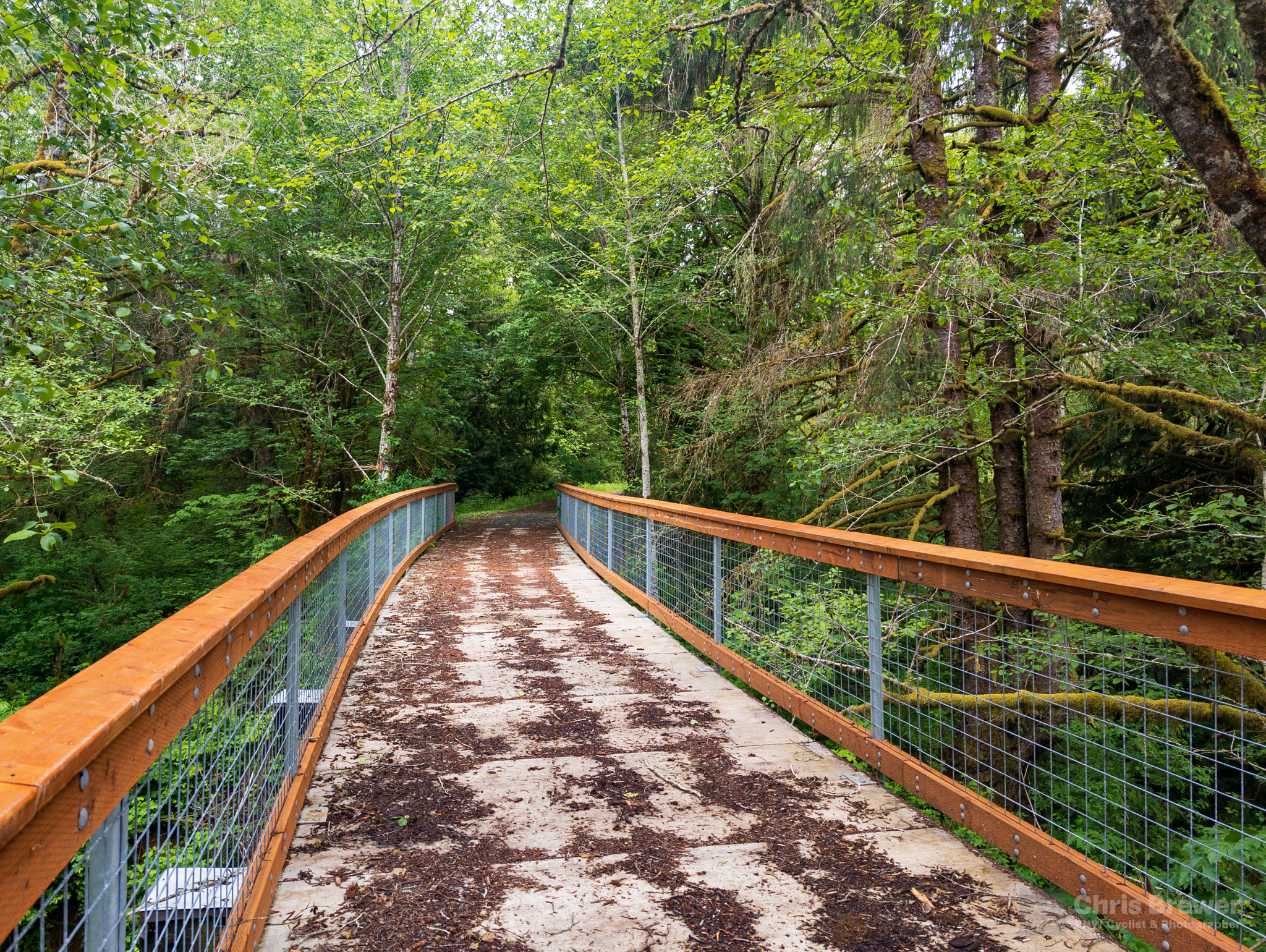
The WHT is a true third place in my life. I’ve met people on the trail who I now ride with, befriended folks in the communities the trail cuts through, and advocated for its continued construction. It’s amazing to see what the trail has become in these past few years as bridges continue to be refurbished, more gravel is laid down on the trail, and grant money is awarded to Parks for further construction.
But while the trail gets closer to full functional completion, it’s not quite there yet — and that’s what actually makes the concept of the Willapa Hills Trail out-and-back again in one day super appealing to me. Over its 56 miles, the gravel surface varies in depth and sometimes just disappears completely in favor of ballast and grass in Pacific County. The wildly varying surface of the trail and the remoteness of it in its farther reaches makes it an adventure for anyone.
And so it was that on May 27, 2023, I tackled the full trail forward and back, starting off riding with my friend Gabe and eventually doing most of the remainder alone. Riding to Raymond was the easy part, but the trip back was a bit tougher. I’m not going to go into much further detail on that ride other than to say I made it, because I’ll share more about the ride I did with a group in 2024 on its anniversary!
Much has changed on the trail since that ride, which renders some of the details of that trip obsolete such as bombing down SR 6 to avoid the twin bridges at mile 32. Those have since been completed. I did the ride again in October 2023 and it was glorious to experience those.
What’s not so glorious: the nondescript trail terminus in South Bend. It just…ends, right next to some sort of water treatment station and a crossing over Highway 6.
So after completing those two rides, I decided to come up with a set of criteria for a ride I wanted to call Megawillapa, which essentially is as much of the trail as you can safely do between Chehalis and South Bend, while starting and ending at the mile 0 marker a short way beyond the parking lot (pictured at the beginning of this section).
I had been wanting to bring some folks with me, so I put out a call on the Northwest Gravel Riders Facebook group and post a ride for May 26. Several folks heeded the call and drove from just about everywhere: Renton, Vancouver, Olympia, and points in between. I drove from my house, parked at my work parking lot, and rode in to meet the group at 7:30.
Ride Report: The Gang Rides It All
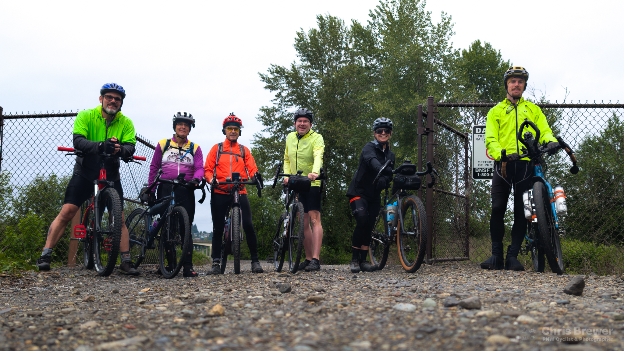
A small but intrepid group gathered at mile 0 of the trail to ride the whole thing in both directions on Sunday, May 26, 2024. From left: Clint, John, Richard, some weird guy, Sarah, and Justin. Natalie would join us later, catching up to us at Adna.
Six of us gathered for a photo at mile 0, where a fence separates State Parks property from BNSF property. After exchanging greetings, pleasantries and handshakes, we all set out on the trail about 7:45 and made our way west. A seventh rider, Natalie, joined us in Adna, catching up from a late start.
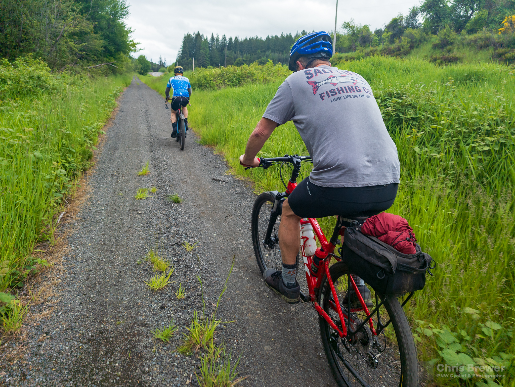
The first 35 miles of the ride went as smoothly as expected, given that a few of us had ridden this portion from Chehalis to Frances out and back. The trees lining the trail are a lush green, the trail a tad soft in places from springtime rains, and the birds giving a nice soundtrack and singing us along on the journey.
Past Frances is where the trail gets a bit rough, but it was smooth going on my Giant Revolt Advanced 2 with 700×40 tires. I had a weird tire setup with my tubeless Maxxis Rambler rear tire rolling at about 45-50 PSI, and a WTB Nano with a tube installed in the front. I had broken a spoke a few weeks back, and off came the tubeless tape to fix it. I didn’t have my sealant injector, so I decided to roll tubed.
And I had no trouble at all. The tires did their job, rolling over ballast, larger rock surfaces, uneven ground, grass and everything the trail threw at it. The group also did well on our westward wanderings, and we were all conscientious to call and point out obstacles or rough areas of trail for those behind us.
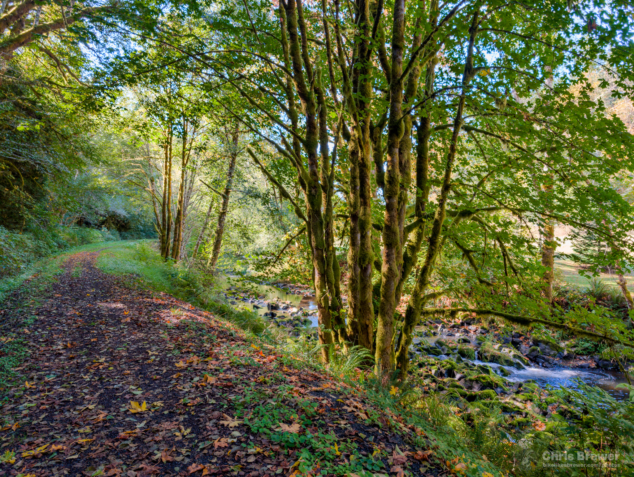
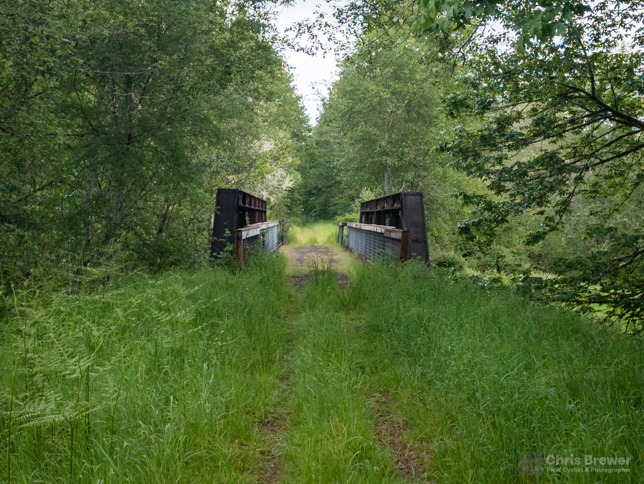
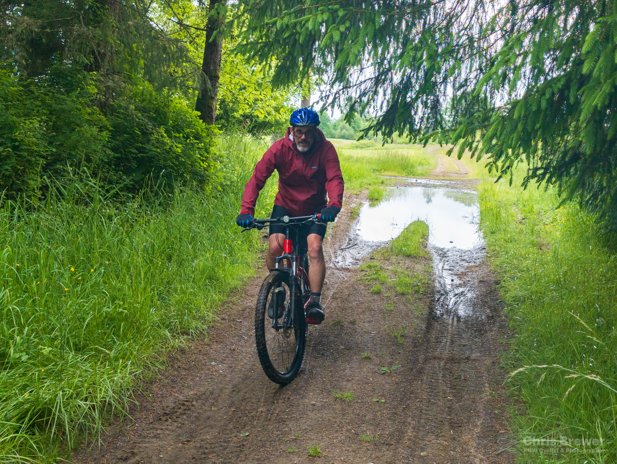
While the first 38 miles of the trail are open, there’s a washout just past Lebam, and fortunately the detour is quick and easy. We popped onto Robertson Road and back down on a crude trail back to the Willapa, where the surface went to completely grass with a bit of dirt in sports to roll through. This section of the trail is aesthetically one of my favorites.
The trail just beyond Menlo is largely untouched except for ATVs and a few cyclists that might be crazy to try riding the whole thing. It’s a beautiful section of trail.
We had to detour again about 10 miles later, just past Lebam at Camp One Road. There’s a trestle that is technically rideable, but State Parks has it closed, so honor their request. We did, and used the shoulder of SR 6 to get us to Heckard Road, where we rejoined the trail.
The trail improves massively at this point, as Parks staff laid down new gravel between Heckard Road and the city of Raymond in 2019. What was once a horrible surface with unimproved trestles has been turned into a nice rolling 3-mile stretch past the old railyard in Willapa and among a collection of houses that become greater in number as you get closer to Raymond.
The weather forecast called for a 40 percent chance of rain throughout the ride, and while showers hit us intermittently, we only really got dumped on once we entered old Willapa, just outside of Raymond. I used RadarScope on my phone to see how big this rainstorm was, and it turned out we only needed to wait 5-10 minutes for it to clear.
Once in Raymond, it was onto pavement and before you knew it, we bid SR 6 a temporary goodbye and crossed US 101. From there, we had to follow a mish-mash of zigs and zags across bridges, streets and some odd configurations to stay parallel to 101 and eventually hit the ride’s terminus in South Bend.
As I said before, the trail’s end is as nondescript as it comes. A rubber curb ends the trail, with no sign, no directions where to go from there, nothing. Hardy cyclists and bikepackers use it to enter US 101 and head down the coast, but we would be turning around here and heading back. We literally waved hello and goodbye to South Bend and decided to turn back, getting a lunch stop in at HomeSlice Pizzeria before continuing back to Chehalis.
The group started to split apart just a little bit, and we ended up finishing in two groups. It ended up being for the best.
We hit the trail back to Chehalis about 2:15 p.m. and figured we could get back by 7 if we minimized our stops. Once we got back onto SR 6 to bypass the eroding trestle going eastbound, the group started to split up a little bit due to some folks needing to slow down a bit and others needing to amp up the pace so they could get back to their car in time.
The way back was tougher than the way over due to what I call the three F’s: fatigue and false flats. The Willapa heading east through the prairies along the Willapa River has several sections of a 1 percent grade, which isn’t bad per se, but when your legs are getting tired and the wind isn’t cooperating, for some folks that 1 percent may as well be 3 or even 6.
Just past Menlo, the four faster riders ended up taking off. Turns out three of them had an hour and a half to drive back home, so I definitely don’t blame them for wanting to get back ASAP! As for the remaining three of us, Justin, Clint and I would end up regrouping together near Lebam and for the most part ride back to Chehalis together.
There was a fourth F to add to this day for a friend on the ride: flats. A real flat, and I’m not talking terrain — I’m talking the thing that forces you off your bike and can prove deflating to both your tire and your spirit. Clint suffered a flat from a couple thorns in the rear tire of his bike, and we spent about 10 minutes getting him up and rolling. We pumped his tire up to about 25-30 psi and he ended up having a cushier ride home as a result.
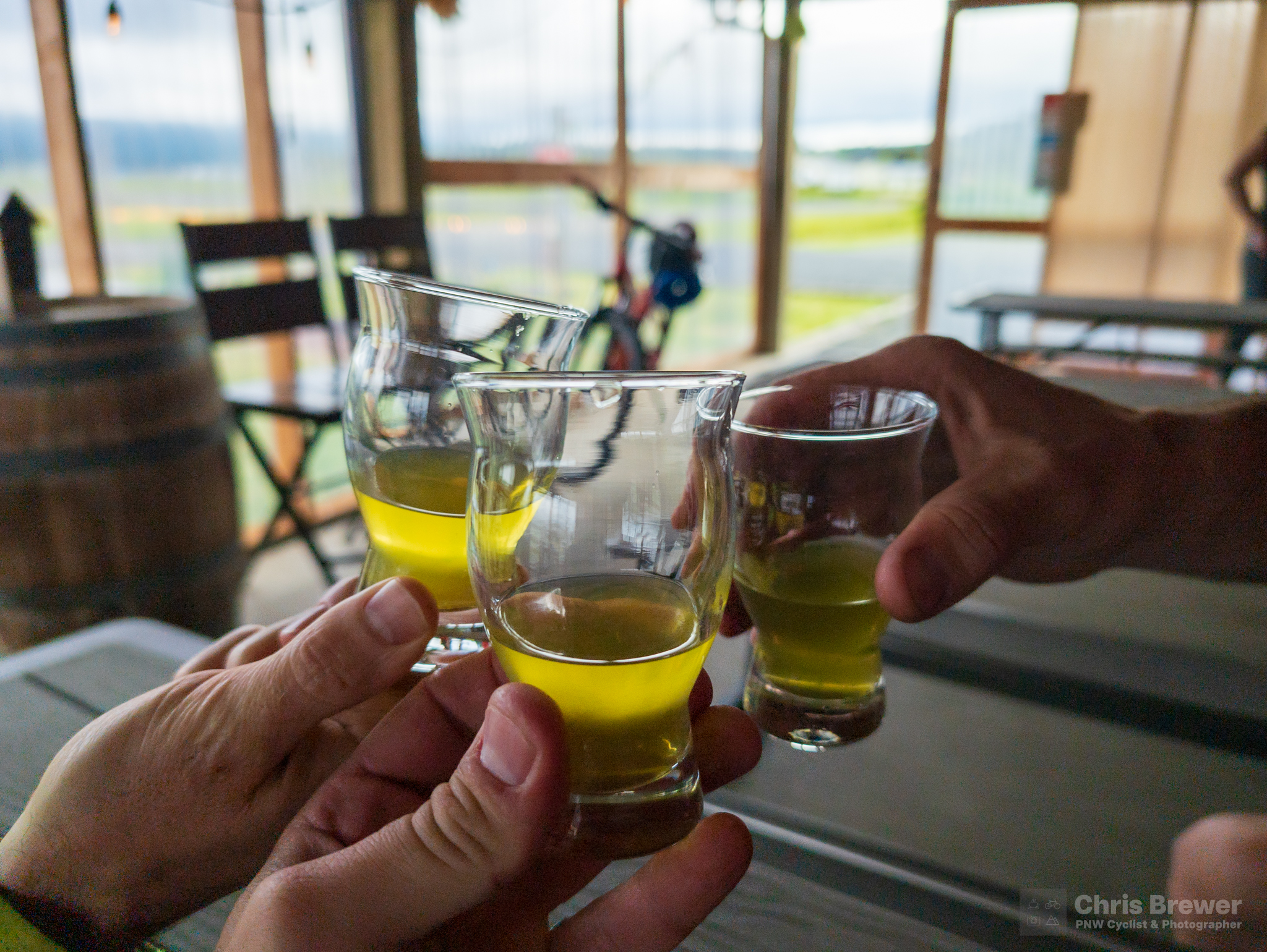
As tired as we felt, the scenery all around us helped invigorate us on the way back. Before we knew it, we had finished the most difficult portions of the ride, advancing back through Lebam, Frances and up through Pluvius again before descending to Pe Ell. Once there, we stopped in over at Jones Creek Brewing, where we enjoyed some root beer, pickle juice, and salty pretzels to carry us home. Thank you Tim and Mirinda for generously staying open a bit later for us!
The rest of the ride was relatively uneventful, even if we did slow down a bit. Clint, Justin and I got to chat for a bit and get to know each other a bit better, and I’d be lying if I didn’t say that was a true highlight of the ride. Riding the Megawillapa alone was a journey, but riding it with others brought a sense of joy to it that I had not felt before.
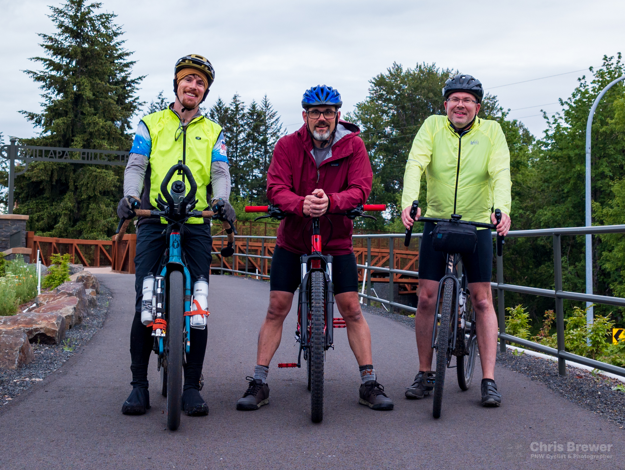
Justin, Clint and me just before the end of the ride. We were in good spirits even though we were tired from the ride!
And I guess that’s where the ride report ends. We all got back to Chehalis safely and confirmed the others had well before us, and the best part of the day was that I made six new friends that I really had never spent any time with on the bike before.
Total mileage was 113 miles, and it was another fantastic day on the Willapa, further enhanced by the people I was blessed to ride with.
You Can Do It Too!
The entire Megawillapa ride is achievable in a day even if you’re not a fast cyclist. If you want a true sense of adventure on a rural trail, the Willapa Hills Trail is a fantastic place to do it. And all 113 miles of the Megawillapa is a heck of an accomplishment.
I urge you to try it sometime if you love gravel biking — and I’ll pass along a few tips that helped me get through it the three times I’ve done it:
Don’t carry a ton of stuff.
Unless you really want to, there’s no need to bring a fully-loaded bike. Bring everything you would on a normal bike ride, some electrolytes and maybe a bit of extra food. Everything you need for the ride is available along the way, as there are corner stores in Pe Ell and Lebam, and a Thriftway in Raymond. Several eateries and a few breweries exist along the way too!
Ride with 40c tires at minimum.
I might even add that a tubeless setup is better for the 12-mile stretch between Frances and Menlo, just because of the unimproved trail that brings a variety of terrain from grass to mud to ballast. I’ve never flatted out on the Megawillapa with a tubeless setup. Sure, part of that is being very aware of my surroundings, but tubeless is the way to go. 40c tires will ensure that you have a comfy enough ride without having to go BIG.
Enjoy the scenery.
There’s a lot of stuff to see, and if you have a keen eye, you can see where old logging railroad grades split off from the old railroad. Eagles make their home along the Chehalis River near the Chehalis Trailhead. And the area between Pe Ell and Frances is just absolutely divine. Bring your cell phone or camera and get ready to take some photos. Half the fun of the Megawillapa is enjoying nature.
Pace yourself and know your limits.
You might be feeling good once you reach the South Bend terminus, but the ride back is a different animal. As I stated before, the false flats in Pacific County can be a bit soul-crushing if there is a headwind or even a big crosswind. And the climb up to Pluvius is a bit more difficult from the east than from the west. Know what you’re capable of and tailor your ride to that.
**
I hope you’ve enjoyed reading this post about what the Megawillapa is, our May group ride on the trail, and the encouragement that you too can do it. Drop me a line if you ever want to talk about the trail or plan a ride. I’m always up for meeting new folks and riding the Willapa together!
Have a blessed week and see you all out there on two wheels soon!